Salvatore Grimaldi , Francesco Cappelli , Simon Michael Papalexiou , Andrea Petroselli , Fernando Nardi , Antonio Annis , Rodolfo Piscopia , Flavia Tauro , Ciro Apollonio
{"title":"Optimizing sensor location for the parsimonious design of flood early warning systems","authors":"Salvatore Grimaldi , Francesco Cappelli , Simon Michael Papalexiou , Andrea Petroselli , Fernando Nardi , Antonio Annis , Rodolfo Piscopia , Flavia Tauro , Ciro Apollonio","doi":"10.1016/j.hydroa.2024.100182","DOIUrl":null,"url":null,"abstract":"<div><p>Flood early warning systems (FEWS) are effective means for saving human lives from the devastating impacts of extreme hydrological events. FEWS relies on hydrologic monitoring networks that are typically expensive and challenging to design. This issue is particularly relevant when identifying the most cost-efficient number, type, and positioning of the sensors for FEWS that may be used to take decisions and alert the population at flood risk.</p><p>In this study, we focus on a widely recognized FEWS solution to analyze hydrological monitoring and forecasting performances expressed as discharge in various cross-sections of a drainage network. We propose and test a novel framework that aims to maximize FEWS performances while minimizing the number of sections that need instrumentation and suggesting optimal sensor placement to enhance forecasting accuracy. In the selected case study, we demonstrate through feature importance measure that only four sub-basins can achieve the same forecasting performance as the potential twenty-six cross-sections of the local hydrologic monitoring network. The operational dashboard resulting from our proposed framework can assist decision-makers in maximizing the performance and wider adoption of flood early warning systems across geographic and socio-economic scales.</p></div>","PeriodicalId":36948,"journal":{"name":"Journal of Hydrology X","volume":"24 ","pages":"Article 100182"},"PeriodicalIF":3.1000,"publicationDate":"2024-08-01","publicationTypes":"Journal Article","fieldsOfStudy":null,"isOpenAccess":false,"openAccessPdf":"https://www.sciencedirect.com/science/article/pii/S2589915524000129/pdfft?md5=01c4d1773b11cc112bf5bb148fa011b1&pid=1-s2.0-S2589915524000129-main.pdf","citationCount":"0","resultStr":null,"platform":"Semanticscholar","paperid":null,"PeriodicalName":"Journal of Hydrology X","FirstCategoryId":"1085","ListUrlMain":"https://www.sciencedirect.com/science/article/pii/S2589915524000129","RegionNum":0,"RegionCategory":null,"ArticlePicture":[],"TitleCN":null,"AbstractTextCN":null,"PMCID":null,"EPubDate":"2024/7/28 0:00:00","PubModel":"Epub","JCR":"Q2","JCRName":"GEOSCIENCES, MULTIDISCIPLINARY","Score":null,"Total":0}
引用次数: 0
Abstract
Flood early warning systems (FEWS) are effective means for saving human lives from the devastating impacts of extreme hydrological events. FEWS relies on hydrologic monitoring networks that are typically expensive and challenging to design. This issue is particularly relevant when identifying the most cost-efficient number, type, and positioning of the sensors for FEWS that may be used to take decisions and alert the population at flood risk.
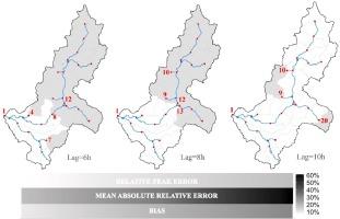
In this study, we focus on a widely recognized FEWS solution to analyze hydrological monitoring and forecasting performances expressed as discharge in various cross-sections of a drainage network. We propose and test a novel framework that aims to maximize FEWS performances while minimizing the number of sections that need instrumentation and suggesting optimal sensor placement to enhance forecasting accuracy. In the selected case study, we demonstrate through feature importance measure that only four sub-basins can achieve the same forecasting performance as the potential twenty-six cross-sections of the local hydrologic monitoring network. The operational dashboard resulting from our proposed framework can assist decision-makers in maximizing the performance and wider adoption of flood early warning systems across geographic and socio-economic scales.


 分享
分享
 求助内容:
求助内容: 应助结果提醒方式:
 扫码关注我们
