Justine A. Neville, Glenn R. Guntenspergen, James B. Grace, Michael J. Osland, Bogdan Chivoiu
{"title":"A Conterminous United States–Wide Validation of Relative Tidal Elevation Products","authors":"Justine A. Neville, Glenn R. Guntenspergen, James B. Grace, Michael J. Osland, Bogdan Chivoiu","doi":"10.1007/s12237-024-01417-9","DOIUrl":null,"url":null,"abstract":"<p>Recent large-scale spatial products have been developed to assess wetland position in the tidal frame, but nationwide comparisons and validations are missing for these products. Wetland position within the tidal frame is a commonly used characteristic to compare wetlands across biogeomorphic gradients and factors heavily into wetland vulnerability models. We utilize a dataset of 365 surface elevation table stations across the conterminous USA containing ground-surveyed tidal datum and elevation data to validate two gridded, conterminous USA–wide relative tidal elevation products. We identified substantial differences between our ground-surveyed dataset and the gridded products, with the Gulf coast exhibiting the greatest error (<i>p</i> < 0.0001, <i>n</i> = 140). Error in relative tidal elevation products varied by coast, tidal range, and latitude. These differences in errors indicate that gridded relative tidal elevation products may be more accurate in coastal wetlands with larger tidal ranges (> 30 cm) and are less accurate in freshwater wetlands near the coast. This paper makes advances in understanding why relative tidal elevation differences occur among national datasets and identifies areas of future work that could support more robust vulnerability models.</p>","PeriodicalId":11921,"journal":{"name":"Estuaries and Coasts","volume":"103 1","pages":""},"PeriodicalIF":2.3000,"publicationDate":"2024-08-20","publicationTypes":"Journal Article","fieldsOfStudy":null,"isOpenAccess":false,"openAccessPdf":"","citationCount":"0","resultStr":null,"platform":"Semanticscholar","paperid":null,"PeriodicalName":"Estuaries and Coasts","FirstCategoryId":"93","ListUrlMain":"https://doi.org/10.1007/s12237-024-01417-9","RegionNum":3,"RegionCategory":"环境科学与生态学","ArticlePicture":[],"TitleCN":null,"AbstractTextCN":null,"PMCID":null,"EPubDate":"","PubModel":"","JCR":"Q3","JCRName":"ENVIRONMENTAL SCIENCES","Score":null,"Total":0}
引用次数: 0
Abstract
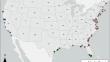
Recent large-scale spatial products have been developed to assess wetland position in the tidal frame, but nationwide comparisons and validations are missing for these products. Wetland position within the tidal frame is a commonly used characteristic to compare wetlands across biogeomorphic gradients and factors heavily into wetland vulnerability models. We utilize a dataset of 365 surface elevation table stations across the conterminous USA containing ground-surveyed tidal datum and elevation data to validate two gridded, conterminous USA–wide relative tidal elevation products. We identified substantial differences between our ground-surveyed dataset and the gridded products, with the Gulf coast exhibiting the greatest error (p < 0.0001, n = 140). Error in relative tidal elevation products varied by coast, tidal range, and latitude. These differences in errors indicate that gridded relative tidal elevation products may be more accurate in coastal wetlands with larger tidal ranges (> 30 cm) and are less accurate in freshwater wetlands near the coast. This paper makes advances in understanding why relative tidal elevation differences occur among national datasets and identifies areas of future work that could support more robust vulnerability models.
期刊介绍:
Estuaries and Coasts is the journal of the Coastal and Estuarine Research Federation (CERF). Begun in 1977 as Chesapeake Science, the journal has gradually expanded its scope and circulation. Today, the journal publishes scholarly manuscripts on estuarine and near coastal ecosystems at the interface between the land and the sea where there are tidal fluctuations or sea water is diluted by fresh water. The interface is broadly defined to include estuaries and nearshore coastal waters including lagoons, wetlands, tidal fresh water, shores and beaches, but not the continental shelf. The journal covers research on physical, chemical, geological or biological processes, as well as applications to management of estuaries and coasts. The journal publishes original research findings, reviews and perspectives, techniques, comments, and management applications. Estuaries and Coasts will consider properly carried out studies that present inconclusive findings or document a failed replication of previously published work. Submissions that are primarily descriptive, strongly place-based, or only report on development of models or new methods without detailing their applications fall outside the scope of the journal.


 分享
分享
 求助内容:
求助内容: 应助结果提醒方式:
 扫码关注我们
