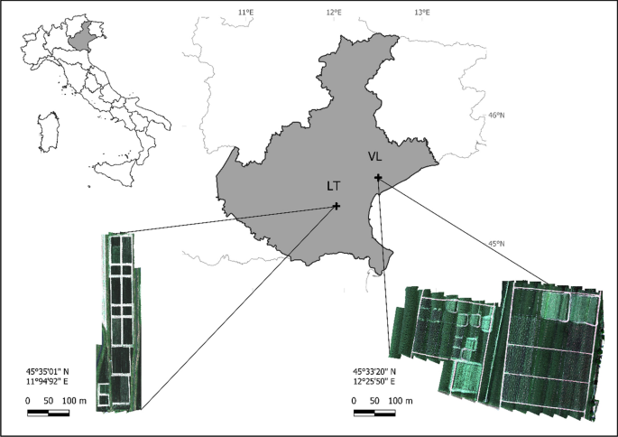
Hailstorms pose a direct threat to agriculture, often causing yield losses and worsening farmers’ agricultural activity. Traditional methods of hail damage estimation, conducted by insurance field inspectors, have been questioned due to their complexity, partial subjectivity, and lack of accounting for spatial variability. Therefore, remote sensing integration in the estimation process could provide a valuable aid. The focus of this study was on winter wheat (Triticum aestivum L.) and its response to damage in the near-infrared (NIR) spectral region, with a particular emphasis on the study of brown pigments as a proxy for yield damage estimation and mapping. An experiment was conducted during two cropping seasons (2020–2021 and 2021–2022) at two sites, simulating hail damage at critical flowering and milky stages using a specifically designed prototype machinery with low, medium, and high damage gradients compared to undamaged conditions in plots with a minimum of 400 m2 area. After the damage simulation, hyperspectral visible-NIR reflectance was measured with Unmanned Aerial Vehicle (UAV) flights, and measurements of chlorophyll and of leaf area index (LAI) were contextually taken. Final yield per treatment was recorded using a combine. An increase in absorbance in the NIR region (780–950 nm) was observed and evaluated using a spectral mixture analysis (SMA) after selecting representative damaged and undamaged vegetation spectra to map the damage. The abundance of damaged endmember pixels per treatment resulted in a good relationship with the final yield (R2 = 0.73), identifying the most damaged areas. The absorbance feature was further analysed with a newly designed multispectral index (TAI), which was tested against a selection of indices and resulted in the highest relationship with the final yield (R2 = 0.64). Both approaches were effective in highlighting the absorbance feature over different dates and development stages, defining an effective mean for hailstorm damage mapping in winter wheat.


