Nadia A. Aziz, Imzahim A. Alwan, Okechukwu E. Agbasi
{"title":"Wadi Sarkhar 雨水收集的地理空间选择:层次分析法--多标准评价方法","authors":"Nadia A. Aziz, Imzahim A. Alwan, Okechukwu E. Agbasi","doi":"10.1007/s12524-024-01882-6","DOIUrl":null,"url":null,"abstract":"<p>Recent environmental issues, rising water demand, and the decreasing supply of natural water resources require the provision of additional quantities of water to ensure the sustainability of ecosystems and water resources. In this study, a systematic approach was used to choose suitable sites for rainwater harvesting (RWH) using an analytic hierarchy process-based multi-criteria evaluation approach in Wadi Sarkhar, Iraq. In order to produce the suitability map, seven criteria layers were used: precipitation, slope, elevation, drainage density, Normalized Difference Vegetation Index (NDVI) obtained from Sentinel 2 data, type of soil, and soil moisture. The area of study has a considerable topographical disparity in altitudes that was ranging from 10 to 2000 m. Special attention was paid to this fact, so the performance of a slope analysis was necessary to identify the sites for RWH appropriately. After analyses of the slope and drainage density layer, new insight about the hydrologic capacity and characteristics was obtained. Long-term precipitation records were essential for determining the sustainability of RWH especially in semi-arid regions. Moreover, the NDVI layer data were used to detect land cover and vegetation distribution. Soil type and soil moisture were utilized to evaluate the ground capacity to retain water. The study area was classified by the final suitability map into three different zones: low suitability, unsuitable zone, and high suitability. This study outcome will provide a systematic approach to the selection of suitable places for RWH, ensure competent management of water resources, and provide an idea about ecosystems and water resources sustainability.</p>","PeriodicalId":17510,"journal":{"name":"Journal of the Indian Society of Remote Sensing","volume":"76 1","pages":""},"PeriodicalIF":2.1000,"publicationDate":"2024-06-05","publicationTypes":"Journal Article","fieldsOfStudy":null,"isOpenAccess":false,"openAccessPdf":"","citationCount":"0","resultStr":"{\"title\":\"Geospatial Selection of Rainwater Harvesting in Wadi Sarkhar: An Analytical Hierarchy Process-Multi-Criteria Evaluation Approach\",\"authors\":\"Nadia A. Aziz, Imzahim A. Alwan, Okechukwu E. Agbasi\",\"doi\":\"10.1007/s12524-024-01882-6\",\"DOIUrl\":null,\"url\":null,\"abstract\":\"<p>Recent environmental issues, rising water demand, and the decreasing supply of natural water resources require the provision of additional quantities of water to ensure the sustainability of ecosystems and water resources. In this study, a systematic approach was used to choose suitable sites for rainwater harvesting (RWH) using an analytic hierarchy process-based multi-criteria evaluation approach in Wadi Sarkhar, Iraq. In order to produce the suitability map, seven criteria layers were used: precipitation, slope, elevation, drainage density, Normalized Difference Vegetation Index (NDVI) obtained from Sentinel 2 data, type of soil, and soil moisture. The area of study has a considerable topographical disparity in altitudes that was ranging from 10 to 2000 m. Special attention was paid to this fact, so the performance of a slope analysis was necessary to identify the sites for RWH appropriately. After analyses of the slope and drainage density layer, new insight about the hydrologic capacity and characteristics was obtained. Long-term precipitation records were essential for determining the sustainability of RWH especially in semi-arid regions. Moreover, the NDVI layer data were used to detect land cover and vegetation distribution. Soil type and soil moisture were utilized to evaluate the ground capacity to retain water. The study area was classified by the final suitability map into three different zones: low suitability, unsuitable zone, and high suitability. This study outcome will provide a systematic approach to the selection of suitable places for RWH, ensure competent management of water resources, and provide an idea about ecosystems and water resources sustainability.</p>\",\"PeriodicalId\":17510,\"journal\":{\"name\":\"Journal of the Indian Society of Remote Sensing\",\"volume\":\"76 1\",\"pages\":\"\"},\"PeriodicalIF\":2.1000,\"publicationDate\":\"2024-06-05\",\"publicationTypes\":\"Journal Article\",\"fieldsOfStudy\":null,\"isOpenAccess\":false,\"openAccessPdf\":\"\",\"citationCount\":\"0\",\"resultStr\":null,\"platform\":\"Semanticscholar\",\"paperid\":null,\"PeriodicalName\":\"Journal of the Indian Society of Remote Sensing\",\"FirstCategoryId\":\"5\",\"ListUrlMain\":\"https://doi.org/10.1007/s12524-024-01882-6\",\"RegionNum\":4,\"RegionCategory\":\"地球科学\",\"ArticlePicture\":[],\"TitleCN\":null,\"AbstractTextCN\":null,\"PMCID\":null,\"EPubDate\":\"\",\"PubModel\":\"\",\"JCR\":\"Q3\",\"JCRName\":\"ENVIRONMENTAL SCIENCES\",\"Score\":null,\"Total\":0}","platform":"Semanticscholar","paperid":null,"PeriodicalName":"Journal of the Indian Society of Remote Sensing","FirstCategoryId":"5","ListUrlMain":"https://doi.org/10.1007/s12524-024-01882-6","RegionNum":4,"RegionCategory":"地球科学","ArticlePicture":[],"TitleCN":null,"AbstractTextCN":null,"PMCID":null,"EPubDate":"","PubModel":"","JCR":"Q3","JCRName":"ENVIRONMENTAL SCIENCES","Score":null,"Total":0}
Geospatial Selection of Rainwater Harvesting in Wadi Sarkhar: An Analytical Hierarchy Process-Multi-Criteria Evaluation Approach
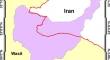
Recent environmental issues, rising water demand, and the decreasing supply of natural water resources require the provision of additional quantities of water to ensure the sustainability of ecosystems and water resources. In this study, a systematic approach was used to choose suitable sites for rainwater harvesting (RWH) using an analytic hierarchy process-based multi-criteria evaluation approach in Wadi Sarkhar, Iraq. In order to produce the suitability map, seven criteria layers were used: precipitation, slope, elevation, drainage density, Normalized Difference Vegetation Index (NDVI) obtained from Sentinel 2 data, type of soil, and soil moisture. The area of study has a considerable topographical disparity in altitudes that was ranging from 10 to 2000 m. Special attention was paid to this fact, so the performance of a slope analysis was necessary to identify the sites for RWH appropriately. After analyses of the slope and drainage density layer, new insight about the hydrologic capacity and characteristics was obtained. Long-term precipitation records were essential for determining the sustainability of RWH especially in semi-arid regions. Moreover, the NDVI layer data were used to detect land cover and vegetation distribution. Soil type and soil moisture were utilized to evaluate the ground capacity to retain water. The study area was classified by the final suitability map into three different zones: low suitability, unsuitable zone, and high suitability. This study outcome will provide a systematic approach to the selection of suitable places for RWH, ensure competent management of water resources, and provide an idea about ecosystems and water resources sustainability.
期刊介绍:
The aims and scope of the Journal of the Indian Society of Remote Sensing are to help towards advancement, dissemination and application of the knowledge of Remote Sensing technology, which is deemed to include photo interpretation, photogrammetry, aerial photography, image processing, and other related technologies in the field of survey, planning and management of natural resources and other areas of application where the technology is considered to be appropriate, to promote interaction among all persons, bodies, institutions (private and/or state-owned) and industries interested in achieving advancement, dissemination and application of the technology, to encourage and undertake research in remote sensing and related technologies and to undertake and execute all acts which shall promote all or any of the aims and objectives of the Indian Society of Remote Sensing.


 分享
分享
 求助内容:
求助内容: 应助结果提醒方式:
 扫码关注我们
