{"title":"美国代表性地点沿海湿地清单的比较及其对变化探测的影响","authors":"Yasin Wahid Rabby, Courtney A. Di Vittorio","doi":"10.1007/s11273-024-09998-9","DOIUrl":null,"url":null,"abstract":"<p>This study aims to help coastal wetland managers understand the differences and trade-offs associated with alternative inventories in the United States (US) through a quantitative comparison of wetland land use land cover (LULC) maps available from the National Wetlands Inventory (NWI), Coastal Change Analysis Program (C-CAP), and Detection and Characterization of Coastal Tidal Wetland (DECODE). NWI and C-CAP were compared in five study sites spread across the Atlantic and Gulf coasts and align well under a four-class system, but discrepancies arise under a nine-class system, with C-CAP generally estimating smaller net wetland areas, larger emergent vegetation areas, and smaller scrub vegetation areas. The average overall accuracy for the C-CAP and NWI comparison is 89.4% and 82.4% for the coarser and finer scale classification systems, respectively. DECODE is available for two of the representative sites and uses a three-class system that differs from that of C-CAP and NWI, causing significant errors and an average overall accuracy of 59.5%. LULC change was quantified during the 1996 to 2016 period using the multi-temporal C-CAP and DECODE maps, showing that DECODE estimates significantly more change, by a factor of fifteen at one study site.. A spatial analysis of the classification differences shows that they often occur near the boundary of two wetland classes and within agricultural and built-up areas. The discrepancies in class definitions, net areas, and change estimates reported in this study should be referenced by managers who are developing wetland policies or management activities, such as carbon flux assessments and resilience plans.</p>","PeriodicalId":49363,"journal":{"name":"Wetlands Ecology and Management","volume":"17 1","pages":""},"PeriodicalIF":1.6000,"publicationDate":"2024-07-05","publicationTypes":"Journal Article","fieldsOfStudy":null,"isOpenAccess":false,"openAccessPdf":"","citationCount":"0","resultStr":"{\"title\":\"Comparison of coastal wetland inventories for representative sites in the United States and implications for change detection\",\"authors\":\"Yasin Wahid Rabby, Courtney A. Di Vittorio\",\"doi\":\"10.1007/s11273-024-09998-9\",\"DOIUrl\":null,\"url\":null,\"abstract\":\"<p>This study aims to help coastal wetland managers understand the differences and trade-offs associated with alternative inventories in the United States (US) through a quantitative comparison of wetland land use land cover (LULC) maps available from the National Wetlands Inventory (NWI), Coastal Change Analysis Program (C-CAP), and Detection and Characterization of Coastal Tidal Wetland (DECODE). NWI and C-CAP were compared in five study sites spread across the Atlantic and Gulf coasts and align well under a four-class system, but discrepancies arise under a nine-class system, with C-CAP generally estimating smaller net wetland areas, larger emergent vegetation areas, and smaller scrub vegetation areas. The average overall accuracy for the C-CAP and NWI comparison is 89.4% and 82.4% for the coarser and finer scale classification systems, respectively. DECODE is available for two of the representative sites and uses a three-class system that differs from that of C-CAP and NWI, causing significant errors and an average overall accuracy of 59.5%. LULC change was quantified during the 1996 to 2016 period using the multi-temporal C-CAP and DECODE maps, showing that DECODE estimates significantly more change, by a factor of fifteen at one study site.. A spatial analysis of the classification differences shows that they often occur near the boundary of two wetland classes and within agricultural and built-up areas. The discrepancies in class definitions, net areas, and change estimates reported in this study should be referenced by managers who are developing wetland policies or management activities, such as carbon flux assessments and resilience plans.</p>\",\"PeriodicalId\":49363,\"journal\":{\"name\":\"Wetlands Ecology and Management\",\"volume\":\"17 1\",\"pages\":\"\"},\"PeriodicalIF\":1.6000,\"publicationDate\":\"2024-07-05\",\"publicationTypes\":\"Journal Article\",\"fieldsOfStudy\":null,\"isOpenAccess\":false,\"openAccessPdf\":\"\",\"citationCount\":\"0\",\"resultStr\":null,\"platform\":\"Semanticscholar\",\"paperid\":null,\"PeriodicalName\":\"Wetlands Ecology and Management\",\"FirstCategoryId\":\"93\",\"ListUrlMain\":\"https://doi.org/10.1007/s11273-024-09998-9\",\"RegionNum\":4,\"RegionCategory\":\"环境科学与生态学\",\"ArticlePicture\":[],\"TitleCN\":null,\"AbstractTextCN\":null,\"PMCID\":null,\"EPubDate\":\"\",\"PubModel\":\"\",\"JCR\":\"Q4\",\"JCRName\":\"ENVIRONMENTAL SCIENCES\",\"Score\":null,\"Total\":0}","platform":"Semanticscholar","paperid":null,"PeriodicalName":"Wetlands Ecology and Management","FirstCategoryId":"93","ListUrlMain":"https://doi.org/10.1007/s11273-024-09998-9","RegionNum":4,"RegionCategory":"环境科学与生态学","ArticlePicture":[],"TitleCN":null,"AbstractTextCN":null,"PMCID":null,"EPubDate":"","PubModel":"","JCR":"Q4","JCRName":"ENVIRONMENTAL SCIENCES","Score":null,"Total":0}
Comparison of coastal wetland inventories for representative sites in the United States and implications for change detection
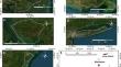
This study aims to help coastal wetland managers understand the differences and trade-offs associated with alternative inventories in the United States (US) through a quantitative comparison of wetland land use land cover (LULC) maps available from the National Wetlands Inventory (NWI), Coastal Change Analysis Program (C-CAP), and Detection and Characterization of Coastal Tidal Wetland (DECODE). NWI and C-CAP were compared in five study sites spread across the Atlantic and Gulf coasts and align well under a four-class system, but discrepancies arise under a nine-class system, with C-CAP generally estimating smaller net wetland areas, larger emergent vegetation areas, and smaller scrub vegetation areas. The average overall accuracy for the C-CAP and NWI comparison is 89.4% and 82.4% for the coarser and finer scale classification systems, respectively. DECODE is available for two of the representative sites and uses a three-class system that differs from that of C-CAP and NWI, causing significant errors and an average overall accuracy of 59.5%. LULC change was quantified during the 1996 to 2016 period using the multi-temporal C-CAP and DECODE maps, showing that DECODE estimates significantly more change, by a factor of fifteen at one study site.. A spatial analysis of the classification differences shows that they often occur near the boundary of two wetland classes and within agricultural and built-up areas. The discrepancies in class definitions, net areas, and change estimates reported in this study should be referenced by managers who are developing wetland policies or management activities, such as carbon flux assessments and resilience plans.
期刊介绍:
Wetlands Ecology and Management is an international journal that publishes authoritative and original articles on topics relevant to freshwater, brackish and marine coastal wetland ecosystems. The Journal serves as a multi-disciplinary forum covering key issues in wetlands science, management, policy and economics. As such, Wetlands Ecology and Management aims to encourage the exchange of information between environmental managers, pure and applied scientists, and national and international authorities on wetlands policy and ecological economics.


 分享
分享
 求助内容:
求助内容: 应助结果提醒方式:
 扫码关注我们
