G. Mariotti, G. Ceccherini, C. R. Alexander, A. C. Spivak
{"title":"美国佐治亚州沿海盐沼面积百年变化与河流、波浪和潮汐造成的大规模沉积物动力学有关","authors":"G. Mariotti, G. Ceccherini, C. R. Alexander, A. C. Spivak","doi":"10.1007/s12237-024-01383-2","DOIUrl":null,"url":null,"abstract":"<p>Marsh lateral expansion and retreat are often attributed to sediment availability, but a causal link is difficult to establish. To shed light on this problem, we analyzed changes in salt marsh area along the ~ 200-km-long Georgia coast (USA) from the 1850s to 2010s in relation to total suspended sediment (TSS) and to proxies for river sediment input and local sediment resuspension. Marsh area is characterized by large gains and losses (up to 200 m<sup>2</sup>/m/yr), but relatively small net change (-50 to 50 m<sup>2</sup>/m/yr or -0.1 to 0.1%/yr). This has resulted in a general loss of marsh area, except close to the mouths of major rivers, where there is net gain. Net expansion rates decreased in the Savannah Estuary but increased in the Altamaha Estuary from the 1850s–1930s period to the 1930s–2010s period, which are consistent with observed decreases and likely increases in sediment discharge in the two estuaries, respectively. To explain the spatial patterns in the 1930s–2010s marsh area change, we estimated TSS from satellite measurements (2003 to 2020). Along the northern part of the Georgia coast, net marsh gain is positively correlated to the average TSS within the estuarine region. However, this correlation breaks down in more southern areas (Cumberland Sound). Coast-wide, there is a better correlation between TSS associated with new input from the rivers, estimated as the TSS difference between high-discharge (Jan–Mar) and low-discharge (Sept–Nov) months. To identify the effect of wave resuspension in the nearshore, we consider the TSS difference between high-wave, low-discharge (Sept–Nov) and low-wave, low-discharge periods (Jun–Aug). Wave resuspension is relatively uniform along the coast and does not explain spatial patterns of marsh area change. Sediment input from the nearshore is likely contributing to the estuarine sediment budget in Georgia, but it is not sufficient to prevent marsh lateral retreat. To identify the role of tidal resuspension and advection, we consider differences in TSS between low and high tide. This differential is relatively constant along most of the coast, but it is much lower in the southern part of the coast, suggesting a lower tidal action in this region. Sediment resuspended by tides is likely originating from internal recycling (i.e., erosion) within the estuary, and thus does not contribute to marsh lateral expansion. The proposed approach to partition TSS is a general demonstration and could be applied to other coastal regions.\n</p>","PeriodicalId":11921,"journal":{"name":"Estuaries and Coasts","volume":"116 1","pages":""},"PeriodicalIF":2.3000,"publicationDate":"2024-07-18","publicationTypes":"Journal Article","fieldsOfStudy":null,"isOpenAccess":false,"openAccessPdf":"","citationCount":"0","resultStr":"{\"title\":\"Centennial Changes of Salt Marsh Area in Coastal Georgia (USA) Related to Large-Scale Sediment Dynamics by River, Waves, and Tides\",\"authors\":\"G. Mariotti, G. Ceccherini, C. R. Alexander, A. C. Spivak\",\"doi\":\"10.1007/s12237-024-01383-2\",\"DOIUrl\":null,\"url\":null,\"abstract\":\"<p>Marsh lateral expansion and retreat are often attributed to sediment availability, but a causal link is difficult to establish. To shed light on this problem, we analyzed changes in salt marsh area along the ~ 200-km-long Georgia coast (USA) from the 1850s to 2010s in relation to total suspended sediment (TSS) and to proxies for river sediment input and local sediment resuspension. Marsh area is characterized by large gains and losses (up to 200 m<sup>2</sup>/m/yr), but relatively small net change (-50 to 50 m<sup>2</sup>/m/yr or -0.1 to 0.1%/yr). This has resulted in a general loss of marsh area, except close to the mouths of major rivers, where there is net gain. Net expansion rates decreased in the Savannah Estuary but increased in the Altamaha Estuary from the 1850s–1930s period to the 1930s–2010s period, which are consistent with observed decreases and likely increases in sediment discharge in the two estuaries, respectively. To explain the spatial patterns in the 1930s–2010s marsh area change, we estimated TSS from satellite measurements (2003 to 2020). Along the northern part of the Georgia coast, net marsh gain is positively correlated to the average TSS within the estuarine region. However, this correlation breaks down in more southern areas (Cumberland Sound). Coast-wide, there is a better correlation between TSS associated with new input from the rivers, estimated as the TSS difference between high-discharge (Jan–Mar) and low-discharge (Sept–Nov) months. To identify the effect of wave resuspension in the nearshore, we consider the TSS difference between high-wave, low-discharge (Sept–Nov) and low-wave, low-discharge periods (Jun–Aug). Wave resuspension is relatively uniform along the coast and does not explain spatial patterns of marsh area change. Sediment input from the nearshore is likely contributing to the estuarine sediment budget in Georgia, but it is not sufficient to prevent marsh lateral retreat. To identify the role of tidal resuspension and advection, we consider differences in TSS between low and high tide. This differential is relatively constant along most of the coast, but it is much lower in the southern part of the coast, suggesting a lower tidal action in this region. Sediment resuspended by tides is likely originating from internal recycling (i.e., erosion) within the estuary, and thus does not contribute to marsh lateral expansion. The proposed approach to partition TSS is a general demonstration and could be applied to other coastal regions.\\n</p>\",\"PeriodicalId\":11921,\"journal\":{\"name\":\"Estuaries and Coasts\",\"volume\":\"116 1\",\"pages\":\"\"},\"PeriodicalIF\":2.3000,\"publicationDate\":\"2024-07-18\",\"publicationTypes\":\"Journal Article\",\"fieldsOfStudy\":null,\"isOpenAccess\":false,\"openAccessPdf\":\"\",\"citationCount\":\"0\",\"resultStr\":null,\"platform\":\"Semanticscholar\",\"paperid\":null,\"PeriodicalName\":\"Estuaries and Coasts\",\"FirstCategoryId\":\"93\",\"ListUrlMain\":\"https://doi.org/10.1007/s12237-024-01383-2\",\"RegionNum\":3,\"RegionCategory\":\"环境科学与生态学\",\"ArticlePicture\":[],\"TitleCN\":null,\"AbstractTextCN\":null,\"PMCID\":null,\"EPubDate\":\"\",\"PubModel\":\"\",\"JCR\":\"Q3\",\"JCRName\":\"ENVIRONMENTAL SCIENCES\",\"Score\":null,\"Total\":0}","platform":"Semanticscholar","paperid":null,"PeriodicalName":"Estuaries and Coasts","FirstCategoryId":"93","ListUrlMain":"https://doi.org/10.1007/s12237-024-01383-2","RegionNum":3,"RegionCategory":"环境科学与生态学","ArticlePicture":[],"TitleCN":null,"AbstractTextCN":null,"PMCID":null,"EPubDate":"","PubModel":"","JCR":"Q3","JCRName":"ENVIRONMENTAL SCIENCES","Score":null,"Total":0}
Centennial Changes of Salt Marsh Area in Coastal Georgia (USA) Related to Large-Scale Sediment Dynamics by River, Waves, and Tides
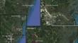
Marsh lateral expansion and retreat are often attributed to sediment availability, but a causal link is difficult to establish. To shed light on this problem, we analyzed changes in salt marsh area along the ~ 200-km-long Georgia coast (USA) from the 1850s to 2010s in relation to total suspended sediment (TSS) and to proxies for river sediment input and local sediment resuspension. Marsh area is characterized by large gains and losses (up to 200 m2/m/yr), but relatively small net change (-50 to 50 m2/m/yr or -0.1 to 0.1%/yr). This has resulted in a general loss of marsh area, except close to the mouths of major rivers, where there is net gain. Net expansion rates decreased in the Savannah Estuary but increased in the Altamaha Estuary from the 1850s–1930s period to the 1930s–2010s period, which are consistent with observed decreases and likely increases in sediment discharge in the two estuaries, respectively. To explain the spatial patterns in the 1930s–2010s marsh area change, we estimated TSS from satellite measurements (2003 to 2020). Along the northern part of the Georgia coast, net marsh gain is positively correlated to the average TSS within the estuarine region. However, this correlation breaks down in more southern areas (Cumberland Sound). Coast-wide, there is a better correlation between TSS associated with new input from the rivers, estimated as the TSS difference between high-discharge (Jan–Mar) and low-discharge (Sept–Nov) months. To identify the effect of wave resuspension in the nearshore, we consider the TSS difference between high-wave, low-discharge (Sept–Nov) and low-wave, low-discharge periods (Jun–Aug). Wave resuspension is relatively uniform along the coast and does not explain spatial patterns of marsh area change. Sediment input from the nearshore is likely contributing to the estuarine sediment budget in Georgia, but it is not sufficient to prevent marsh lateral retreat. To identify the role of tidal resuspension and advection, we consider differences in TSS between low and high tide. This differential is relatively constant along most of the coast, but it is much lower in the southern part of the coast, suggesting a lower tidal action in this region. Sediment resuspended by tides is likely originating from internal recycling (i.e., erosion) within the estuary, and thus does not contribute to marsh lateral expansion. The proposed approach to partition TSS is a general demonstration and could be applied to other coastal regions.
期刊介绍:
Estuaries and Coasts is the journal of the Coastal and Estuarine Research Federation (CERF). Begun in 1977 as Chesapeake Science, the journal has gradually expanded its scope and circulation. Today, the journal publishes scholarly manuscripts on estuarine and near coastal ecosystems at the interface between the land and the sea where there are tidal fluctuations or sea water is diluted by fresh water. The interface is broadly defined to include estuaries and nearshore coastal waters including lagoons, wetlands, tidal fresh water, shores and beaches, but not the continental shelf. The journal covers research on physical, chemical, geological or biological processes, as well as applications to management of estuaries and coasts. The journal publishes original research findings, reviews and perspectives, techniques, comments, and management applications. Estuaries and Coasts will consider properly carried out studies that present inconclusive findings or document a failed replication of previously published work. Submissions that are primarily descriptive, strongly place-based, or only report on development of models or new methods without detailing their applications fall outside the scope of the journal.


 分享
分享
 求助内容:
求助内容: 应助结果提醒方式:
 扫码关注我们
