{"title":"利用声纳系统探测海底气体排放区","authors":"V. I. Kaevitser, V. M. Smirnov, I. V. Smolyaninov","doi":"10.1134/s0001437024700280","DOIUrl":null,"url":null,"abstract":"<h3 data-test=\"abstract-sub-heading\">Abstract</h3><p>The study presents and analyzes the experimental results of geological and geomorphological observations in some marine areas with active gas emission from bottom sediments. The study was carried out using an instrumental complex of geophysical sonar equipment, which included a subbottom profiler and side scan bathymetric sonar that uses an interferometric method for measuring depths in the field of view. The results confirm the possibility of using the complex to classify the seabed morphology and control the processes of gas unloading. The use of sonar equipment for remote seabed mapping during satellite observations can be used to interpret the results of satellite remote sensing of the atmosphere.</p>","PeriodicalId":54692,"journal":{"name":"Oceanology","volume":"7 1","pages":""},"PeriodicalIF":0.8000,"publicationDate":"2024-08-26","publicationTypes":"Journal Article","fieldsOfStudy":null,"isOpenAccess":false,"openAccessPdf":"","citationCount":"0","resultStr":"{\"title\":\"Use of Sonar Systems to Detect Areas of Gas Discharge of the Seabed\",\"authors\":\"V. I. Kaevitser, V. M. Smirnov, I. V. Smolyaninov\",\"doi\":\"10.1134/s0001437024700280\",\"DOIUrl\":null,\"url\":null,\"abstract\":\"<h3 data-test=\\\"abstract-sub-heading\\\">Abstract</h3><p>The study presents and analyzes the experimental results of geological and geomorphological observations in some marine areas with active gas emission from bottom sediments. The study was carried out using an instrumental complex of geophysical sonar equipment, which included a subbottom profiler and side scan bathymetric sonar that uses an interferometric method for measuring depths in the field of view. The results confirm the possibility of using the complex to classify the seabed morphology and control the processes of gas unloading. The use of sonar equipment for remote seabed mapping during satellite observations can be used to interpret the results of satellite remote sensing of the atmosphere.</p>\",\"PeriodicalId\":54692,\"journal\":{\"name\":\"Oceanology\",\"volume\":\"7 1\",\"pages\":\"\"},\"PeriodicalIF\":0.8000,\"publicationDate\":\"2024-08-26\",\"publicationTypes\":\"Journal Article\",\"fieldsOfStudy\":null,\"isOpenAccess\":false,\"openAccessPdf\":\"\",\"citationCount\":\"0\",\"resultStr\":null,\"platform\":\"Semanticscholar\",\"paperid\":null,\"PeriodicalName\":\"Oceanology\",\"FirstCategoryId\":\"89\",\"ListUrlMain\":\"https://doi.org/10.1134/s0001437024700280\",\"RegionNum\":4,\"RegionCategory\":\"地球科学\",\"ArticlePicture\":[],\"TitleCN\":null,\"AbstractTextCN\":null,\"PMCID\":null,\"EPubDate\":\"\",\"PubModel\":\"\",\"JCR\":\"Q4\",\"JCRName\":\"OCEANOGRAPHY\",\"Score\":null,\"Total\":0}","platform":"Semanticscholar","paperid":null,"PeriodicalName":"Oceanology","FirstCategoryId":"89","ListUrlMain":"https://doi.org/10.1134/s0001437024700280","RegionNum":4,"RegionCategory":"地球科学","ArticlePicture":[],"TitleCN":null,"AbstractTextCN":null,"PMCID":null,"EPubDate":"","PubModel":"","JCR":"Q4","JCRName":"OCEANOGRAPHY","Score":null,"Total":0}
Use of Sonar Systems to Detect Areas of Gas Discharge of the Seabed
Abstract
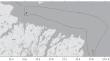
The study presents and analyzes the experimental results of geological and geomorphological observations in some marine areas with active gas emission from bottom sediments. The study was carried out using an instrumental complex of geophysical sonar equipment, which included a subbottom profiler and side scan bathymetric sonar that uses an interferometric method for measuring depths in the field of view. The results confirm the possibility of using the complex to classify the seabed morphology and control the processes of gas unloading. The use of sonar equipment for remote seabed mapping during satellite observations can be used to interpret the results of satellite remote sensing of the atmosphere.
期刊介绍:
Oceanology, founded in 1961, is the leading journal in all areas of the marine sciences. It publishes original papers in all fields of theoretical and experimental research in physical, chemical, biological, geological, and technical oceanology. The journal also offers reviews and information about conferences, symposia, cruises, and other events of interest to the oceanographic community.


 分享
分享
 求助内容:
求助内容: 应助结果提醒方式:
 扫码关注我们
