Jacob L. Strunk;Diogo N. Cosenza;Francisco Mauro;Hans-Erik Andersen;Sytze de Bruin;Timothy Bryant;Petteri Packalen
{"title":"基于区域的激光雷达森林清查的空间效应缓解(2024)","authors":"Jacob L. Strunk;Diogo N. Cosenza;Francisco Mauro;Hans-Erik Andersen;Sytze de Bruin;Timothy Bryant;Petteri Packalen","doi":"10.1109/JSTARS.2025.3528834","DOIUrl":null,"url":null,"abstract":"Different sizes and shapes of field plots relative to raster grid cells were found to negatively affect lidar augmented forest inventory. This issue is called the “change of spatial support problem (COSP)” and caused biases and reduction in estimation efficiency (precision per number of plots). For a ∼14 000 km<sup>2</sup> study area in Oregon State, USA, we examined three different plot shapes, both fixed-radius and cluster plots, alongside grid cell sizes ranging from 5 to 70 m. Effect size varied with the magnitude of spatial mismatch between plots and raster grid cells. There was up to 15% bias and a 98% reduction in estimation efficiency. Fortunately, no negative effects were observed for circle (plots) versus square (grid cell) shaped regions with the same areas (m<sup>2</sup>). This study contributes to the sparse body of literature around change of spatial support in the area-based approach to lidar forest inventory and provides methods to easily avoid and mitigate negative effects. The simplest approach to avoid bias, although not always practical or feasible, is to exactly match the area (m<sup>2</sup>) of circular field plots and raster grid cells. Use of metrics robust to spatial effects, such as median height and height ratios, can also reduce change of spatial support effects. Finally, we demonstrate that attribution of plots directly from raster grid cells (the “raster-intersect” approach) is robust to change of spatial support and flexible in application, but sacrifices a small amount of predictive power (a glossary of technical terminology is also provided in the appendix).","PeriodicalId":13116,"journal":{"name":"IEEE Journal of Selected Topics in Applied Earth Observations and Remote Sensing","volume":"18 ","pages":"5287-5302"},"PeriodicalIF":6.3000,"publicationDate":"2025-01-16","publicationTypes":"Journal Article","fieldsOfStudy":null,"isOpenAccess":false,"openAccessPdf":"https://ieeexplore.ieee.org/stamp/stamp.jsp?tp=&arnumber=10843354","citationCount":"0","resultStr":"{\"title\":\"Mitigation of Spatial Effects on an Area-Based Lidar Forest Inventory (2024)\",\"authors\":\"Jacob L. Strunk;Diogo N. Cosenza;Francisco Mauro;Hans-Erik Andersen;Sytze de Bruin;Timothy Bryant;Petteri Packalen\",\"doi\":\"10.1109/JSTARS.2025.3528834\",\"DOIUrl\":null,\"url\":null,\"abstract\":\"Different sizes and shapes of field plots relative to raster grid cells were found to negatively affect lidar augmented forest inventory. This issue is called the “change of spatial support problem (COSP)” and caused biases and reduction in estimation efficiency (precision per number of plots). For a ∼14 000 km<sup>2</sup> study area in Oregon State, USA, we examined three different plot shapes, both fixed-radius and cluster plots, alongside grid cell sizes ranging from 5 to 70 m. Effect size varied with the magnitude of spatial mismatch between plots and raster grid cells. There was up to 15% bias and a 98% reduction in estimation efficiency. Fortunately, no negative effects were observed for circle (plots) versus square (grid cell) shaped regions with the same areas (m<sup>2</sup>). This study contributes to the sparse body of literature around change of spatial support in the area-based approach to lidar forest inventory and provides methods to easily avoid and mitigate negative effects. The simplest approach to avoid bias, although not always practical or feasible, is to exactly match the area (m<sup>2</sup>) of circular field plots and raster grid cells. Use of metrics robust to spatial effects, such as median height and height ratios, can also reduce change of spatial support effects. Finally, we demonstrate that attribution of plots directly from raster grid cells (the “raster-intersect” approach) is robust to change of spatial support and flexible in application, but sacrifices a small amount of predictive power (a glossary of technical terminology is also provided in the appendix).\",\"PeriodicalId\":13116,\"journal\":{\"name\":\"IEEE Journal of Selected Topics in Applied Earth Observations and Remote Sensing\",\"volume\":\"18 \",\"pages\":\"5287-5302\"},\"PeriodicalIF\":6.3000,\"publicationDate\":\"2025-01-16\",\"publicationTypes\":\"Journal Article\",\"fieldsOfStudy\":null,\"isOpenAccess\":false,\"openAccessPdf\":\"https://ieeexplore.ieee.org/stamp/stamp.jsp?tp=&arnumber=10843354\",\"citationCount\":\"0\",\"resultStr\":null,\"platform\":\"Semanticscholar\",\"paperid\":null,\"PeriodicalName\":\"IEEE Journal of Selected Topics in Applied Earth Observations and Remote Sensing\",\"FirstCategoryId\":\"5\",\"ListUrlMain\":\"https://ieeexplore.ieee.org/document/10843354/\",\"RegionNum\":2,\"RegionCategory\":\"地球科学\",\"ArticlePicture\":[],\"TitleCN\":null,\"AbstractTextCN\":null,\"PMCID\":null,\"EPubDate\":\"\",\"PubModel\":\"\",\"JCR\":\"Q1\",\"JCRName\":\"ENGINEERING, ELECTRICAL & ELECTRONIC\",\"Score\":null,\"Total\":0}","platform":"Semanticscholar","paperid":null,"PeriodicalName":"IEEE Journal of Selected Topics in Applied Earth Observations and Remote Sensing","FirstCategoryId":"5","ListUrlMain":"https://ieeexplore.ieee.org/document/10843354/","RegionNum":2,"RegionCategory":"地球科学","ArticlePicture":[],"TitleCN":null,"AbstractTextCN":null,"PMCID":null,"EPubDate":"","PubModel":"","JCR":"Q1","JCRName":"ENGINEERING, ELECTRICAL & ELECTRONIC","Score":null,"Total":0}
Mitigation of Spatial Effects on an Area-Based Lidar Forest Inventory (2024)
Different sizes and shapes of field plots relative to raster grid cells were found to negatively affect lidar augmented forest inventory. This issue is called the “change of spatial support problem (COSP)” and caused biases and reduction in estimation efficiency (precision per number of plots). For a ∼14 000 km2 study area in Oregon State, USA, we examined three different plot shapes, both fixed-radius and cluster plots, alongside grid cell sizes ranging from 5 to 70 m. Effect size varied with the magnitude of spatial mismatch between plots and raster grid cells. There was up to 15% bias and a 98% reduction in estimation efficiency. Fortunately, no negative effects were observed for circle (plots) versus square (grid cell) shaped regions with the same areas (m2). This study contributes to the sparse body of literature around change of spatial support in the area-based approach to lidar forest inventory and provides methods to easily avoid and mitigate negative effects. The simplest approach to avoid bias, although not always practical or feasible, is to exactly match the area (m2) of circular field plots and raster grid cells. Use of metrics robust to spatial effects, such as median height and height ratios, can also reduce change of spatial support effects. Finally, we demonstrate that attribution of plots directly from raster grid cells (the “raster-intersect” approach) is robust to change of spatial support and flexible in application, but sacrifices a small amount of predictive power (a glossary of technical terminology is also provided in the appendix).
期刊介绍:
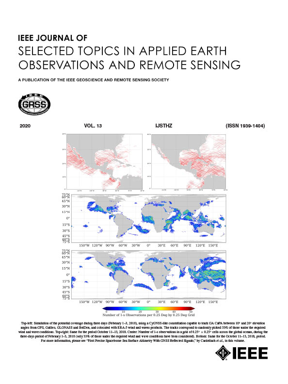
The IEEE Journal of Selected Topics in Applied Earth Observations and Remote Sensing addresses the growing field of applications in Earth observations and remote sensing, and also provides a venue for the rapidly expanding special issues that are being sponsored by the IEEE Geosciences and Remote Sensing Society. The journal draws upon the experience of the highly successful “IEEE Transactions on Geoscience and Remote Sensing” and provide a complementary medium for the wide range of topics in applied earth observations. The ‘Applications’ areas encompasses the societal benefit areas of the Global Earth Observations Systems of Systems (GEOSS) program. Through deliberations over two years, ministers from 50 countries agreed to identify nine areas where Earth observation could positively impact the quality of life and health of their respective countries. Some of these are areas not traditionally addressed in the IEEE context. These include biodiversity, health and climate. Yet it is the skill sets of IEEE members, in areas such as observations, communications, computers, signal processing, standards and ocean engineering, that form the technical underpinnings of GEOSS. Thus, the Journal attracts a broad range of interests that serves both present members in new ways and expands the IEEE visibility into new areas.




 京公网安备 11010802042870号
京ICP备2023020795号-1
京公网安备 11010802042870号
京ICP备2023020795号-1

 分享
分享
 求助内容:
求助内容: 应助结果提醒方式:
 扫码关注我们
