Sarah Cipkar, Hanna Maoh, Terence Dimatulac, Frazier Fathers, Shereen Arcis, Anneke Smit
{"title":"超越感知:安大略省温莎住宅地段独立ADU潜力的空间分析","authors":"Sarah Cipkar, Hanna Maoh, Terence Dimatulac, Frazier Fathers, Shereen Arcis, Anneke Smit","doi":"10.1111/cag.12840","DOIUrl":null,"url":null,"abstract":"<p>This paper analyzes the spatial potential of detached additional dwelling units (ADUs) in Windsor, Ontario. A new GIS model, which integrates various geoprocessing commands in ArcGIS 10.8.1, is developed to calculate whether the minimum allowable size of a detached ADU can fit within the total buildable area of a residential property, based on the setbacks, the lot coverage requirements, and other factors (such as parking and flood plain areas). The model uses publicly sourced data that were obtained from the City of Windsor's Open Data Portal. More specifically, individual residential parcels and associated building footprints along with street centerlines are used as inputs to the model. The outputs are then categorized into three types (suitable, potentially suitable, and not suitable) to demonstrate where detached ADUs can be built in compliance with the local zoning bylaws, on both an individual lot basis and at an aggregate level. The conducted analysis reveals the potential of existing residential neighbourhoods in a mid-size city, and has many implications for homeowners, policymakers, and researchers with respect to increasing housing supply within current Canadian municipalities.</p>","PeriodicalId":47619,"journal":{"name":"Canadian Geographer-Geographe Canadien","volume":null,"pages":null},"PeriodicalIF":1.4000,"publicationDate":"2023-04-10","publicationTypes":"Journal Article","fieldsOfStudy":null,"isOpenAccess":false,"openAccessPdf":"https://onlinelibrary.wiley.com/doi/epdf/10.1111/cag.12840","citationCount":"0","resultStr":"{\"title\":\"Beyond perception: Spatial analysis of detached ADU potential on residential lots in Windsor, Ontario\",\"authors\":\"Sarah Cipkar, Hanna Maoh, Terence Dimatulac, Frazier Fathers, Shereen Arcis, Anneke Smit\",\"doi\":\"10.1111/cag.12840\",\"DOIUrl\":null,\"url\":null,\"abstract\":\"<p>This paper analyzes the spatial potential of detached additional dwelling units (ADUs) in Windsor, Ontario. A new GIS model, which integrates various geoprocessing commands in ArcGIS 10.8.1, is developed to calculate whether the minimum allowable size of a detached ADU can fit within the total buildable area of a residential property, based on the setbacks, the lot coverage requirements, and other factors (such as parking and flood plain areas). The model uses publicly sourced data that were obtained from the City of Windsor's Open Data Portal. More specifically, individual residential parcels and associated building footprints along with street centerlines are used as inputs to the model. The outputs are then categorized into three types (suitable, potentially suitable, and not suitable) to demonstrate where detached ADUs can be built in compliance with the local zoning bylaws, on both an individual lot basis and at an aggregate level. The conducted analysis reveals the potential of existing residential neighbourhoods in a mid-size city, and has many implications for homeowners, policymakers, and researchers with respect to increasing housing supply within current Canadian municipalities.</p>\",\"PeriodicalId\":47619,\"journal\":{\"name\":\"Canadian Geographer-Geographe Canadien\",\"volume\":null,\"pages\":null},\"PeriodicalIF\":1.4000,\"publicationDate\":\"2023-04-10\",\"publicationTypes\":\"Journal Article\",\"fieldsOfStudy\":null,\"isOpenAccess\":false,\"openAccessPdf\":\"https://onlinelibrary.wiley.com/doi/epdf/10.1111/cag.12840\",\"citationCount\":\"0\",\"resultStr\":null,\"platform\":\"Semanticscholar\",\"paperid\":null,\"PeriodicalName\":\"Canadian Geographer-Geographe Canadien\",\"FirstCategoryId\":\"90\",\"ListUrlMain\":\"https://onlinelibrary.wiley.com/doi/10.1111/cag.12840\",\"RegionNum\":4,\"RegionCategory\":\"社会学\",\"ArticlePicture\":[],\"TitleCN\":null,\"AbstractTextCN\":null,\"PMCID\":null,\"EPubDate\":\"\",\"PubModel\":\"\",\"JCR\":\"Q2\",\"JCRName\":\"GEOGRAPHY\",\"Score\":null,\"Total\":0}","platform":"Semanticscholar","paperid":null,"PeriodicalName":"Canadian Geographer-Geographe Canadien","FirstCategoryId":"90","ListUrlMain":"https://onlinelibrary.wiley.com/doi/10.1111/cag.12840","RegionNum":4,"RegionCategory":"社会学","ArticlePicture":[],"TitleCN":null,"AbstractTextCN":null,"PMCID":null,"EPubDate":"","PubModel":"","JCR":"Q2","JCRName":"GEOGRAPHY","Score":null,"Total":0}
Beyond perception: Spatial analysis of detached ADU potential on residential lots in Windsor, Ontario
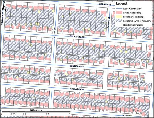
This paper analyzes the spatial potential of detached additional dwelling units (ADUs) in Windsor, Ontario. A new GIS model, which integrates various geoprocessing commands in ArcGIS 10.8.1, is developed to calculate whether the minimum allowable size of a detached ADU can fit within the total buildable area of a residential property, based on the setbacks, the lot coverage requirements, and other factors (such as parking and flood plain areas). The model uses publicly sourced data that were obtained from the City of Windsor's Open Data Portal. More specifically, individual residential parcels and associated building footprints along with street centerlines are used as inputs to the model. The outputs are then categorized into three types (suitable, potentially suitable, and not suitable) to demonstrate where detached ADUs can be built in compliance with the local zoning bylaws, on both an individual lot basis and at an aggregate level. The conducted analysis reveals the potential of existing residential neighbourhoods in a mid-size city, and has many implications for homeowners, policymakers, and researchers with respect to increasing housing supply within current Canadian municipalities.


 分享
分享
 求助内容:
求助内容: 应助结果提醒方式:
 扫码关注我们
