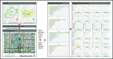
Urbanization witnessed unprecedented development globally, which causes citizens and urban temperature to become increasingly intertwined. Although researchers were interested in the field, most studies focused on holistic linear links between the characteristics of the urban built-up environment and temperature. The study used Bayesian optimization ensemble learning and Shapley value to decouple the urban thermal environment by Landsat satellite data. This work's novelties reveal the specific driving effect of different value ranges of urban features in the overall process on the urban thermal environment and advancing an optimum observation buffer zone of the urban surface temperature. The study's results were only for daytime and Beijing scope. The following are the main findings: (1) The 2 km observation buffer zone is best to analyze the urban thermal environment for this dataset. (2) The ecological environment factors have a more significant effect on the urban temperature than the urban morphology factors. (3) In summer, when the vegetation coverage exceeds 58.1%, every 10% increase could reduce the temperature by 0.84 °C. In contrast to summer, when vegetation coverage exceeds 64.7% and 73.2%, respectively, in spring and fall, there will be a significant marginal utility. (4) The effect of the building height has seasonal variations. It has the greatest cooling effect in the spring when the height is between 18 m and 75 m, and the daytime surface temperature at the time of Landsat overpass will drop by 1.25 °C. These findings will aid in understanding how building construction influences urban surface temperature and provide statistical support for planners.


