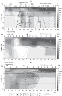
Abstract—A series of magnetotelluric and seismic studies have been carried out on profiles covering more than two thousand kilometers within the North Caucasus region. The earlier interpretation of the magnetotelluric observations by means of one– and two–dimensional inversion and three–dimensional mathematical modeling software has helped to construct a series of sections and models which are viewed as test and starting ones for the construction of a three–dimensional geoelectric model of the region. The test models have been used to test how well the software for three–dimensional inversion of the impedance tensor components in the magnetotelluric sounding method can estimate the parameters of conducting blocks in the structures of the Greater Caucasus and the Scythian plate. In the resulting geoelectric model, constructed from the results of three–dimensional inversion of all impedance tensor components, the position of low–resistance blocks correlates with deep faults, volcanoes of various genesis, and seismically active zones characterized by the reduced velocity of seismic waves and their increased absorption. The electrical resistivity of low–resistance anomalies is explained by the degree of their saturation with the fluid water fraction. Its maximum concentration is found within the intersections of fault systems, flexural–rupture zones, and deep faults activated by tectonic processes.


