{"title":"埃塞俄比亚湿地清查,变化的关键驱动因素及其社会经济和环境影响","authors":"Workiyie Worie Assefa , Belachew Getnet Eneyew","doi":"10.1016/j.ecolind.2025.113312","DOIUrl":null,"url":null,"abstract":"<div><div>Efforts have been made to estimate the total areas of wetlands coverage and their distribution in Ethiopia. However, their abundance and distribution throughout the country remain unclear. This study, thus, aimed to assess the status and dynamics of wetlands coverage in Ethiopia. Besides, the drivers of wetland degradation and its implications on water supply, local people’s livelihoods, climate change, and biodiversity. Global Land Analysis and Discovery (GLAD), and Global Wetland Database were used to analyze abundance distribution and dynamics of wetlands in Ethiopia. The documentary sources (journal articles and books) were used to assess the driving factors of wetland degradation and the implications of wetland loss. The global wetland dataset analysis findings indicated that the total area coverage of the country’s wetlands in 2020 was 26,424.72 km<sup>2</sup> representing 2.02 % of the country’s total area coverage. Of which, 16,501.96 km<sup>2</sup> was covered with wetlands and 9,922.76 km<sup>2</sup> was covered with open-water (lakes and artificial reservoirs). The analysis of the<!--> <!-->LULC pattern indicated that the land coverage of open-water had increased by 20 % within 20 years (2000 to 2020), which was contradictory to the decline of 9 % of the wetland coverage. The construction of dams or reservoirs for hydroelectric supply, irrigation, and water supply for large towns or cities is the principal factor for increasing open-water coverage. On the contrary, cultivated land expansion, increasing the application of agrochemicals, overgrazing, lack of standalone wetland policy, sedimentation, climate change, excessive extraction of water for irrigation and other purposes, and urban expansion contribute to the degradation of wetlands. Considerable loss of wetlands will have implications on water supply for various uses, local level livelihoods, local climate regulation, carbon emission, and aquatic biodiversity<em>.</em></div></div>","PeriodicalId":11459,"journal":{"name":"Ecological Indicators","volume":"172 ","pages":"Article 113312"},"PeriodicalIF":7.0000,"publicationDate":"2025-03-01","publicationTypes":"Journal Article","fieldsOfStudy":null,"isOpenAccess":false,"openAccessPdf":"","citationCount":"0","resultStr":"{\"title\":\"Wetland inventory, key drivers of change and their socioeconomic and environmental implications in Ethiopia\",\"authors\":\"Workiyie Worie Assefa , Belachew Getnet Eneyew\",\"doi\":\"10.1016/j.ecolind.2025.113312\",\"DOIUrl\":null,\"url\":null,\"abstract\":\"<div><div>Efforts have been made to estimate the total areas of wetlands coverage and their distribution in Ethiopia. However, their abundance and distribution throughout the country remain unclear. This study, thus, aimed to assess the status and dynamics of wetlands coverage in Ethiopia. Besides, the drivers of wetland degradation and its implications on water supply, local people’s livelihoods, climate change, and biodiversity. Global Land Analysis and Discovery (GLAD), and Global Wetland Database were used to analyze abundance distribution and dynamics of wetlands in Ethiopia. The documentary sources (journal articles and books) were used to assess the driving factors of wetland degradation and the implications of wetland loss. The global wetland dataset analysis findings indicated that the total area coverage of the country’s wetlands in 2020 was 26,424.72 km<sup>2</sup> representing 2.02 % of the country’s total area coverage. Of which, 16,501.96 km<sup>2</sup> was covered with wetlands and 9,922.76 km<sup>2</sup> was covered with open-water (lakes and artificial reservoirs). The analysis of the<!--> <!-->LULC pattern indicated that the land coverage of open-water had increased by 20 % within 20 years (2000 to 2020), which was contradictory to the decline of 9 % of the wetland coverage. The construction of dams or reservoirs for hydroelectric supply, irrigation, and water supply for large towns or cities is the principal factor for increasing open-water coverage. On the contrary, cultivated land expansion, increasing the application of agrochemicals, overgrazing, lack of standalone wetland policy, sedimentation, climate change, excessive extraction of water for irrigation and other purposes, and urban expansion contribute to the degradation of wetlands. Considerable loss of wetlands will have implications on water supply for various uses, local level livelihoods, local climate regulation, carbon emission, and aquatic biodiversity<em>.</em></div></div>\",\"PeriodicalId\":11459,\"journal\":{\"name\":\"Ecological Indicators\",\"volume\":\"172 \",\"pages\":\"Article 113312\"},\"PeriodicalIF\":7.0000,\"publicationDate\":\"2025-03-01\",\"publicationTypes\":\"Journal Article\",\"fieldsOfStudy\":null,\"isOpenAccess\":false,\"openAccessPdf\":\"\",\"citationCount\":\"0\",\"resultStr\":null,\"platform\":\"Semanticscholar\",\"paperid\":null,\"PeriodicalName\":\"Ecological Indicators\",\"FirstCategoryId\":\"93\",\"ListUrlMain\":\"https://www.sciencedirect.com/science/article/pii/S1470160X25002432\",\"RegionNum\":2,\"RegionCategory\":\"环境科学与生态学\",\"ArticlePicture\":[],\"TitleCN\":null,\"AbstractTextCN\":null,\"PMCID\":null,\"EPubDate\":\"2025/3/10 0:00:00\",\"PubModel\":\"Epub\",\"JCR\":\"Q1\",\"JCRName\":\"ENVIRONMENTAL SCIENCES\",\"Score\":null,\"Total\":0}","platform":"Semanticscholar","paperid":null,"PeriodicalName":"Ecological Indicators","FirstCategoryId":"93","ListUrlMain":"https://www.sciencedirect.com/science/article/pii/S1470160X25002432","RegionNum":2,"RegionCategory":"环境科学与生态学","ArticlePicture":[],"TitleCN":null,"AbstractTextCN":null,"PMCID":null,"EPubDate":"2025/3/10 0:00:00","PubModel":"Epub","JCR":"Q1","JCRName":"ENVIRONMENTAL SCIENCES","Score":null,"Total":0}
Wetland inventory, key drivers of change and their socioeconomic and environmental implications in Ethiopia
Efforts have been made to estimate the total areas of wetlands coverage and their distribution in Ethiopia. However, their abundance and distribution throughout the country remain unclear. This study, thus, aimed to assess the status and dynamics of wetlands coverage in Ethiopia. Besides, the drivers of wetland degradation and its implications on water supply, local people’s livelihoods, climate change, and biodiversity. Global Land Analysis and Discovery (GLAD), and Global Wetland Database were used to analyze abundance distribution and dynamics of wetlands in Ethiopia. The documentary sources (journal articles and books) were used to assess the driving factors of wetland degradation and the implications of wetland loss. The global wetland dataset analysis findings indicated that the total area coverage of the country’s wetlands in 2020 was 26,424.72 km2 representing 2.02 % of the country’s total area coverage. Of which, 16,501.96 km2 was covered with wetlands and 9,922.76 km2 was covered with open-water (lakes and artificial reservoirs). The analysis of the LULC pattern indicated that the land coverage of open-water had increased by 20 % within 20 years (2000 to 2020), which was contradictory to the decline of 9 % of the wetland coverage. The construction of dams or reservoirs for hydroelectric supply, irrigation, and water supply for large towns or cities is the principal factor for increasing open-water coverage. On the contrary, cultivated land expansion, increasing the application of agrochemicals, overgrazing, lack of standalone wetland policy, sedimentation, climate change, excessive extraction of water for irrigation and other purposes, and urban expansion contribute to the degradation of wetlands. Considerable loss of wetlands will have implications on water supply for various uses, local level livelihoods, local climate regulation, carbon emission, and aquatic biodiversity.
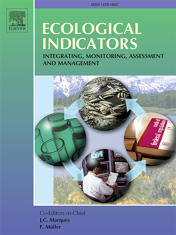
期刊介绍:
The ultimate aim of Ecological Indicators is to integrate the monitoring and assessment of ecological and environmental indicators with management practices. The journal provides a forum for the discussion of the applied scientific development and review of traditional indicator approaches as well as for theoretical, modelling and quantitative applications such as index development. Research into the following areas will be published.
• All aspects of ecological and environmental indicators and indices.
• New indicators, and new approaches and methods for indicator development, testing and use.
• Development and modelling of indices, e.g. application of indicator suites across multiple scales and resources.
• Analysis and research of resource, system- and scale-specific indicators.
• Methods for integration of social and other valuation metrics for the production of scientifically rigorous and politically-relevant assessments using indicator-based monitoring and assessment programs.
• How research indicators can be transformed into direct application for management purposes.
• Broader assessment objectives and methods, e.g. biodiversity, biological integrity, and sustainability, through the use of indicators.
• Resource-specific indicators such as landscape, agroecosystems, forests, wetlands, etc.




 京公网安备 11010802042870号
京ICP备2023020795号-1
京公网安备 11010802042870号
京ICP备2023020795号-1

 分享
分享
 求助内容:
求助内容: 应助结果提醒方式:
 扫码关注我们
