Horizon-assisted lithologic modeling: understanding Mississippi Embayment and Coastal Lowlands aquifer systems in Louisiana and southwestern Mississippi, USA
{"title":"Horizon-assisted lithologic modeling: understanding Mississippi Embayment and Coastal Lowlands aquifer systems in Louisiana and southwestern Mississippi, USA","authors":"Shuo Yang, Frank T-C Tsai, Lance D. Yarbrough","doi":"10.1007/s10040-024-02804-z","DOIUrl":null,"url":null,"abstract":"<p>The Mississippi Embayment aquifer system (MEAS) and the Coastal Lowlands aquifer system (CLAS) are two principal aquifers in the US Gulf Coastal Plain. Despite their importance to the region, a comprehensive characterization of these aquifers has not been achieved yet. In this study, the horizon-assisted lithologic modeling (HALM) method is introduced to integrate horizon structures and well log data for aquifer characterization. By employing horizon restorations, the HALM method proves to be versatile in incorporating various geologic features into lithologic models. The HALM method was applied to characterize both the MEAS and the CLAS in the Louisiana and southwestern Mississippi regions. The resulting large-scale high-resolution hydrostratigraphic model provides a highly accurate representation of aquifer structures in regionally extensive hydrogeologic units, including synclines, angular unconformities, and faulting. Notably, the model highlights the presence of surficial coarse sediments, indicating significant groundwater recharge zones for the Southern Hills aquifer system, the Chicot aquifer, and the Sparta aquifer. Additionally, the Mississippi River alluvial aquifer and the Chicot aquifer are found to be thick and shallow, making them easily accessible for irrigation purposes. Furthermore, the model reveals significant connections between rivers and alluvial aquifers in northern Louisiana, with reduced river–aquifer contact as one approaches the Gulf of Mexico. Comparing the two aquifer systems, the CLAS exhibits relatively thick and extensive aquifers compared to the MEAS. This study not only contributes to advancements in geologic modeling techniques but also enhances the understanding of regional hydrogeology in the US Gulf Coastal Plain.</p>","PeriodicalId":13013,"journal":{"name":"Hydrogeology Journal","volume":"46 1","pages":""},"PeriodicalIF":2.3000,"publicationDate":"2024-06-27","publicationTypes":"Journal Article","fieldsOfStudy":null,"isOpenAccess":false,"openAccessPdf":"","citationCount":"0","resultStr":null,"platform":"Semanticscholar","paperid":null,"PeriodicalName":"Hydrogeology Journal","FirstCategoryId":"89","ListUrlMain":"https://doi.org/10.1007/s10040-024-02804-z","RegionNum":3,"RegionCategory":"地球科学","ArticlePicture":[],"TitleCN":null,"AbstractTextCN":null,"PMCID":null,"EPubDate":"","PubModel":"","JCR":"Q2","JCRName":"GEOSCIENCES, MULTIDISCIPLINARY","Score":null,"Total":0}
引用次数: 0
Abstract
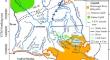
The Mississippi Embayment aquifer system (MEAS) and the Coastal Lowlands aquifer system (CLAS) are two principal aquifers in the US Gulf Coastal Plain. Despite their importance to the region, a comprehensive characterization of these aquifers has not been achieved yet. In this study, the horizon-assisted lithologic modeling (HALM) method is introduced to integrate horizon structures and well log data for aquifer characterization. By employing horizon restorations, the HALM method proves to be versatile in incorporating various geologic features into lithologic models. The HALM method was applied to characterize both the MEAS and the CLAS in the Louisiana and southwestern Mississippi regions. The resulting large-scale high-resolution hydrostratigraphic model provides a highly accurate representation of aquifer structures in regionally extensive hydrogeologic units, including synclines, angular unconformities, and faulting. Notably, the model highlights the presence of surficial coarse sediments, indicating significant groundwater recharge zones for the Southern Hills aquifer system, the Chicot aquifer, and the Sparta aquifer. Additionally, the Mississippi River alluvial aquifer and the Chicot aquifer are found to be thick and shallow, making them easily accessible for irrigation purposes. Furthermore, the model reveals significant connections between rivers and alluvial aquifers in northern Louisiana, with reduced river–aquifer contact as one approaches the Gulf of Mexico. Comparing the two aquifer systems, the CLAS exhibits relatively thick and extensive aquifers compared to the MEAS. This study not only contributes to advancements in geologic modeling techniques but also enhances the understanding of regional hydrogeology in the US Gulf Coastal Plain.
期刊介绍:
Hydrogeology Journal was founded in 1992 to foster understanding of hydrogeology; to describe worldwide progress in hydrogeology; and to provide an accessible forum for scientists, researchers, engineers, and practitioners in developing and industrialized countries.
Since then, the journal has earned a large worldwide readership. Its peer-reviewed research articles integrate subsurface hydrology and geology with supporting disciplines: geochemistry, geophysics, geomorphology, geobiology, surface-water hydrology, tectonics, numerical modeling, economics, and sociology.


 分享
分享
 求助内容:
求助内容: 应助结果提醒方式:
 扫码关注我们
